Introduction
Version 3.8.0 for version 1.8 of the CF conventions.
The Python cf package is an Earth Science data analysis library that is built on a complete implementation of the CF data model.
Functionality
The cf package implements the CF data model 1 for its internal data structures and so is able to process any CF-compliant dataset. It is not strict about CF-compliance, however, so that partially conformant datasets may be ingested from existing datasets and written to new datasets.This is so that datasets that are partially conformant may nonetheless be modified in memory.
>>> import cf
>>> f = cf.read('file.nc')
>>> f
[<CF Field: air_temperature(time(12), latitude(64), longitude(128)) K>]
>>> print(f[0])
Field: air_temperature (ncvar%tas)
----------------------------------
Data            : air_temperature(time(12), latitude(64), longitude(128)) K
Cell methods    : time(12): mean (interval: 1.0 month)
Dimension coords: time(12) = [0450-11-16 00:00:00, ..., 0451-10-16 12:00:00] noleap
                : latitude(64) = [-87.8638, ..., 87.8638] degrees_north
                : longitude(128) = [0.0, ..., 357.1875] degrees_east
                : height(1) = [2.0] m
The cf package can:
read field constructs from netCDF, CDL, PP and UM datasets,
create new field constructs in memory,
inspect field constructs,
test whether two field constructs are the same,
modify field construct metadata and data,
create subspaces of field constructs,
write field constructs to netCDF datasets on disk,
incorporate, and create, metadata stored in external files (new in version 3.0.0),
read, write, and create data that have been compressed by convention (i.e. ragged or gathered arrays), whilst presenting a view of the data in its uncompressed form,
read, write, and create coordinates defined by geometry cells (new in version 3.2.0),
read netCDF and CDL datasets containing hierarchical groups (new in version 3.6.0),
combine field constructs arithmetically,
manipulate field construct data by arithmetical and trigonometrical operations,
perform statistical collapses on field constructs,
perform histogram, percentile and binning operations on field constructs (new in version 3.0.3),
regrid field constructs with (multi-)linear, nearest neighbour, first- and second-order conservative and higher order patch recovery methods,
apply convolution filters to field constructs,
create moving means from field constructs (new in version 3.3.0),
calculate derivatives of field constructs,
create field constructs to create derived quantities (such as vorticity).
All of the above use LAMA functionality, which allows multiple fields larger than the available memory to exist and be manipulated.
Visualization
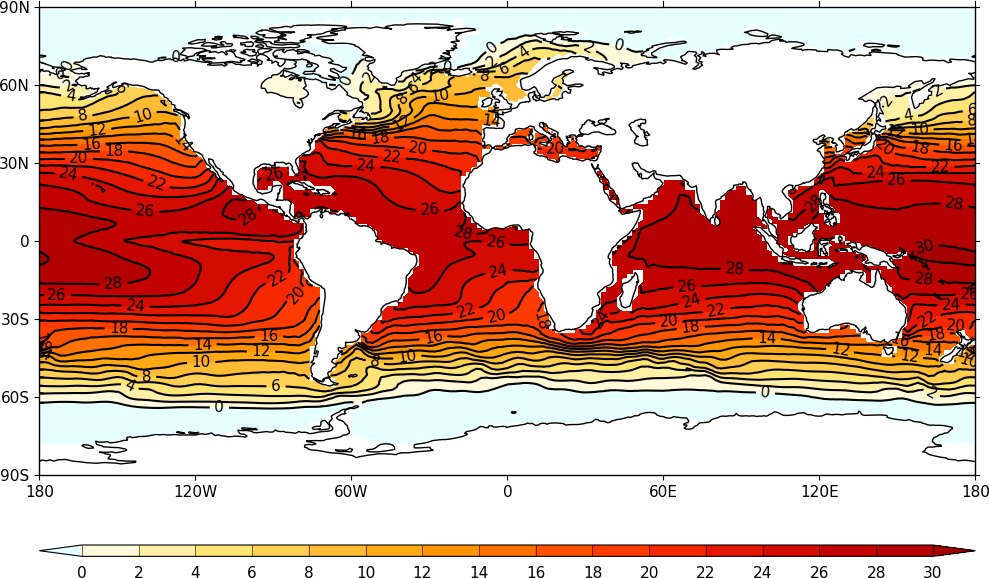
Powerful, flexible, and very simple to produce visualizations of field
constructs are available with the cfplot package, that is installed
separately to cf (see http://ajheaps.github.io/cf-plot for details).
See the cfplot gallery for the wide range range plotting possibilities with example code.

Example output of cfplot displaying a cf field construct.
Old versions
Since version 3.0.0, cf is for Python 3 only and there are incompatible differences between versions 2.x and 3.x of cf.
Scripts written for version 2.x but running under version 3.x should either work as expected, or provide informative error messages on the new API usage. However, it is advised that the outputs of older scripts are checked when running with Python 3 versions of the cf library.
For version 2.x documentation, see the releases page.
- 1
Hassell, D., Gregory, J., Blower, J., Lawrence, B. N., and Taylor, K. E.: A data model of the Climate and Forecast metadata conventions (CF-1.6) with a software implementation (cf-python v2.1), Geosci. Model Dev., 10, 4619-4646, https://doi.org/10.5194/gmd-10-4619-2017, 2017.